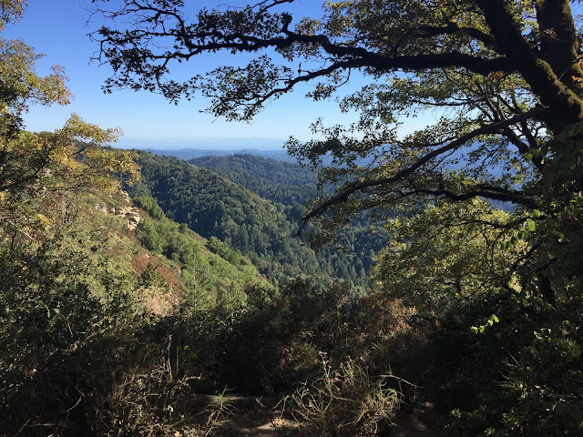
Jan 1st, 2018 at Castle Rock State Park

Going back in time.....
Here's a fresh start to the 2018 new year (which could apply to 2020 haha), with a nice hike at Sempervirens Point of Castle Rock State Park (see the location data on the side). Some of my posts will be like this, where I just walk you through the hike....
Path Profile of Hike: HeyWhat'sThat Profile (sorry, the link is reallllly long!!)
Stats of Hike:
Distance ~1.9 miles
Elevation Profile:
Max Elevation 2615 ft
Min Elevation 2372 ft
Difference: +243 ft
Difficulty: Easy (short distance, moderate elevation gains)
Difficulty: Easy (short distance, moderate elevation gains)
Trail Routing Summit Meadows Trail, then back on Skyline-to-the-Sea Trail
Parks Covered Long Ridge Open Space Preserve, then Castle Rock State Park
Trail Profile
First, we start off at the Sempervirens Point parking lot, and see our first view as we head on the Summit Meadows Trail:
We arrived at the afternoon, so the scenery wasn't as clear as it would have been during the morning. However, the view still offers a nice panorama over Big Basin State Park (the valley straight ahead) and over to Año Nuevo State Park (the ocean up ahead).
Note the grass is still beginning to grow, since this is early January and the temperatures haven't warmed up enough for grasses to sprout yet... not to mention a more impressive complex of poppies and lupines....
We head off, away from the initial parking lot at Sempervirens Point (the house on the right is actually a bathroom)....
And into the tan oak/douglas-fir forest... (not to be confused with live-oak, which lives on more dry slopes of Santa Clara County)
Picture of a tan-oak (Notholithocarpus densiflorus) under a Douglas Fir forest.
Here's another picturesque view of the Pacific (to the South) from the Summit Meadows Trail, with Douglas Fir leaves hanging in from the top:
Picture of surrounding Douglas Fir (Pseudotsuga menziesii) forest, facing Año Nuevo. Leaves hanging on top is also part of a Douglas Fir tree next to the viewpoint.
Here's another view of the surrounding mountains, to the West. The rocks you see are actually part of the main entrance of Castle Rock State Park, right off Highway 35 South! And those rocks, over there, are actually what makes Castle Rock State Park get its name - its distinctive, rocky nature! (see my other posts for the main entrance of Castle Rock State Park)
Photo of Castle Rock SP - Skyline Entrance to the west. The mountains to your right face towards Monterey Bay if you want to go that far :) To your left, you have a nice pine (Pinus ponderosa) tree growing - if you stop by here, you might even see a giant pine (Bull Pine?) growing here! I personally saw one, and just to tell you how big the pine cone was, it was about the size of a grapefruit!
Now we cross the road, and end up on the east side of the hill (Skyline-to-the-Sea Trail). Here, it's much more forested, with a mix of Douglas Firs and Coast Redwoods, with understory Sword Ferns and Tan Oak. I saw a couple of large trees on the way back ("giants" as naturalists call them).
Here's a view of a Douglas Fir tree on the way - just to give you perspective, the tree trunk on your right can fit about six adult human beings if it was hollowed out!
Some nice sword-ferns on the way...
Another big tree - a Coast Redwood (Sequoia sempervirens) on the way back to the parking lot.
The afternoon shade provided a nice angle for the Douglas firs to make a nice picture of the slopes facing North towards Half Moon Bay:
Nice afternoon scenery :)
We cut across the entrance of Long Ridge OSP (nice ring of redwoods there):
....and, now we're back. Note the amount of cars: a lot of them came here to celebrate January 1st by flying kites, balloons, etc.
Back to the parking lot! :-)
All in all, a really nice hike. Not too far, around 2 miles, but there was a lot of plants and opportunities for views!


Comments
Post a Comment