Oct 2, 2016 at Picchetti Ranch Open Space Preserve

Stats of Hike:
Distance ~2.3 miles out-and-back
Elevation Profile:
Max Elevation 971 ft
Min Elevation 850 ft
Difference: +112 ft
Difficulty: Easy (short hike; small elevation gain)
Difficulty: Easy (short hike; small elevation gain)
Trail Routing Zinfandel Trail (named after Zinfandel Wine in CA, perhaps)
Parks Covered MROSD Picchetti Ranch Open Space Preserve
Trail Profile
Trail Profile

Looks like a large elevation gain... from 850 ft to 950 ft.... but is it??? Well, the start is slightly challenging, but it gets relatively flat once you enter the forest.

Going up Orchard Loop Trail....

This used to be a wet pond, but due to CA's long 2011-2017 drought, it's doesn't even exist...

Looking south, towards Mt. Umunhum.

Into the forest! To your front is the Pacific Madrone (Arbutus menziesii), commonly known as the refrigerator tree – if you touch its "naked" bark, you can feel how cold it is...

A 180° view of the surrounding hills. That grey formation to your left is an old, abandoned quarry in Stevens Creek County Park.
Note the distinct, puffy–shaped clouds to your top-left: those are Cumulonimbus (thunderstorm-producing) clouds, not something you see everyday in California's dry, Mediterranean climate... There must have been a lot of atmospheric energy that day, maybe CAPE (Convective Available Potential Energy) that day was around ≈ 1000 J/kg??

Here's a nice view of when the understory forest ascends to the drier, chaparral community where you can find smaller shrubs.
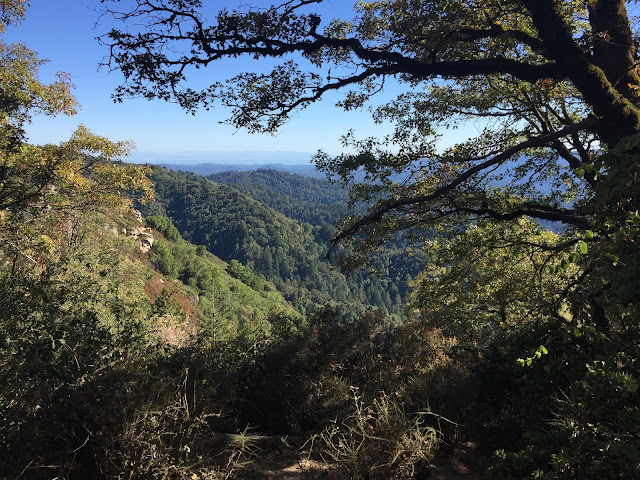
Look at the nice view of the reservoir! You can very slightly see a view of the cities of Mountain View and Sunnyvale sandwiched between the two hills. The reservoir is part of Stevens Creek County Park, a place I blogged just a few posts ago. Hidden to your left is the Stevens Creek Quarry and the Los Altos Gun Range. Notice the winding switchbacks of the Stevens Creek Tony Look Trail to your right.

Wild roses (genus Rosa).... these hips are actually edible and can be used to male tea! However, they are sour and tart – avoid the fine hairs inside the rose, as they may itch!

A picture of the Zinfandel trail, named after a type of grape used to make wine around the area.
**Trail routes of all the places I've hiked (Google Maps): https://drive.google.com/open?id=15GpkKZ7JtkH-r1rvxLeR14fcMmo&usp=sharing**

Comments
Post a Comment