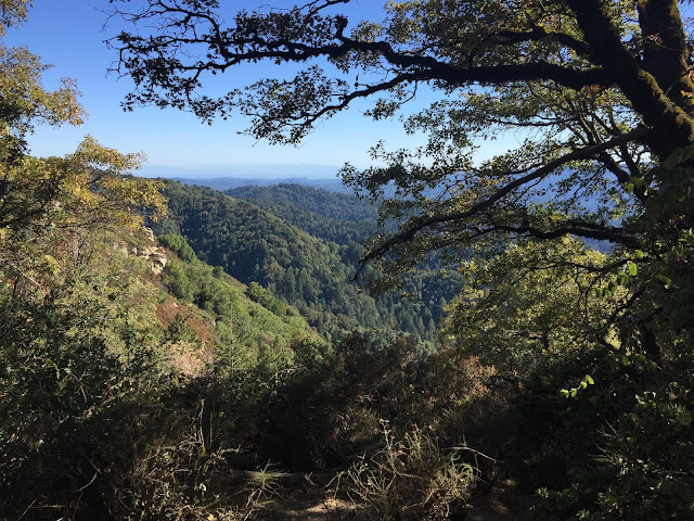
Sept 24, 2016 at Castle Rock State Park
Stats of Hike:
Distance ~3 miles out-and-back then loop, loop intersects with original trail (Saratoga Gap Trail) via Ridge Trail.
Elevation Profile:
Max Elevation 3,068 ft
Min Elevation 2,602 ft
Difference: +466 ft
Difficulty: Moderate (moderately uphill)
Difficulty: Moderate (moderately uphill)
Trail Routing Saratoga Gap Trail --> Interconnector Trail --> Ridge Trail --> Saratoga Gap Trail (Parking on Skyline Blvd)
Parks Covered Castle Rock State Park
Trail Profile
Trail Profile
Keep in mind the elevation profile before you go!!! When you park at Skyline, you're actually around the TOP of your hike. As you go, you quickly lose elevation before the ~2 mile mark (at a viewpoint around the rock grove) and slowly climb back up. Since it's downhill then uphill, I would consider this a ~harder "moderate" hike. +/- 466 ft
Note the distinct, sandstone formations. The State Park brochure lists this as ~30-40 million years old, due to earthquake formations. And, indeed, this location is very close to the San Andreas Fault, where earthquakes frequently bring up sandstone formations. (There I am, right underneath the rock! :-) )
A paranomic view of the west from the Observation Deck at Castle Rock Falls viewpoint. At this time of the year, there's little water to be found around the area (as CA has a Mediterranean climate season).
Another view of the sandstone formations. They are often covered in moss, due to the surrounding black-oak forest, lush with sword-ferns.
After we arrive on Ridge Trail, we are easily exposed to the open nature of the Chaparral vegetation zone. Here on the front over the mountains, you can see what would be the Pacific Ocean (it's hard to see in the afternoon). Again, you can see the distinct, scattered rock outcrops in Castle Rock State Park, accompanied by the manzanita plants and the serpentine soil!
Another view. The "shiny" stuff in your front is literally the Pacific Ocean, reflecting its rays from the sun.
Me next to a giant sandstone rock. Often you would see people climbing these rocks - rock-climbing is certainly a fun activity here in Castle Rock!
Here's the viewpoint. To your left, you have Monterey Bay. To the right, you head north towards Half Moon Bay.
A picturesque view facing the Monterey Bay, with the oak tree on your right giving it a nice "painting-like" effect. Feel free to watercolor and let me know how it goes- I bet it'll be AWESOME!
Ditto. This time for people who like looking at vertical pictures or want a vertical wallpaper :). Feel free!
More rock outcroppings along the chaparral zone. See that brown "path" near the bottom of the upper rocks? That's where we're going!
A lot of beetles/insects really love eating stuff here....as seen with this maple-looking leaf...
**Trail routes of all the places I've hiked (Google Maps): https://drive.google.com/open?id=15GpkKZ7JtkH-r1rvxLeR14fcMmo&usp=sharing**


Comments
Post a Comment